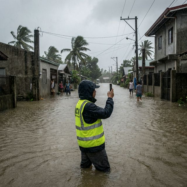
Filipinos don't wait for permission to help. When a road caves in, when a typhoon floods a barangay, when an electric pole falls across a highway—citizens are the first to know, the first to document, the first to sound the alarm. But all that energy gets scattered across Facebook groups, Messenger threads, radio hotlines, and LGU whiteboards. The spirit of Bayanihan is there. The infrastructure is not.
The Problem: Fragmentation Costs Lives—and Livelihood
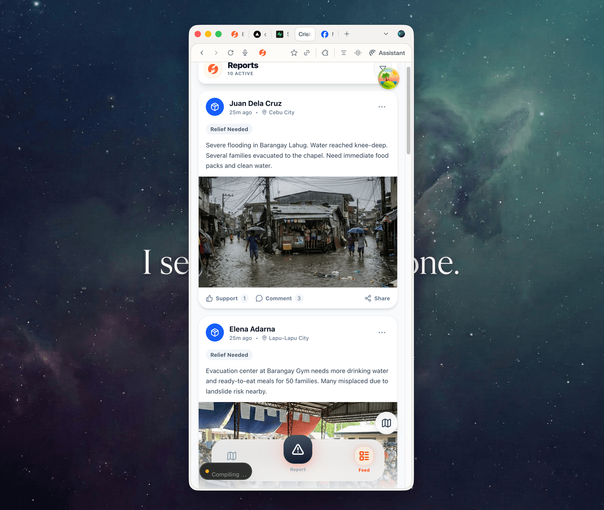
Picture this: it's 2 AM during Typhoon Basyang. A mother in Barangay Lahug posts a photo of chest-high floodwater in a private Facebook group with 12,000 members. The post gets 200 reactions—but the CDRRMO never sees it. They're monitoring a different group. Meanwhile, a duplicate report is called in via radio, logged on a clipboard, and lost in the shift change.
Now picture a regular Tuesday: a pothole on Osmeña Boulevard has been swallowing motorbikes for three weeks. Residents have posted about it in their community Facebook group. The barangay captain has seen it but has no formal way to escalate it to the city engineering office. A downed electric pole has been reported to VECO by phone, but the neighborhood is also posting about it on Messenger. Nobody knows what's been reported, to whom, or what's being done about it.
This is how community reporting works today across most Philippine municipalities—for emergencies and everyday issues alike. The tools are fragmented. The data is unstructured. And the gap between a citizen flagging a problem and an LGU acting on it is filled with noise, duplication, and dangerous delays.
The problem isn't a lack of information—it's a flood of the wrong kind. Unverified posts, outdated threads, duplicate reports, and algorithm-buried pleas for help. LGUs spend hours sifting through social media when they should be dispatching crews.
The Solution: One Pipeline, Two Directions
Dasig Bantay (“Dasig Report”) is not another app. It is civic infrastructure—a single, centralized pipeline that replaces the patchwork of tools communities currently rely on, whether it's a Category 5 typhoon or a busted street light.
The platform operates as a two-way system:
- Upstream (Intelligence Gathering) — Citizens on the ground submit structured reports on anything from flooding and rescue needs to road damage, power outages, and relief distribution gaps. They are the sensors.
- Downstream (Dispatch & Response) — LGU dispatchers triage verified reports, assign responders or work crews, and close the loop. They are the operators.
Neither side works alone. Upstream without a dispatcher is just more noise. A dispatcher without upstream intelligence is flying blind. Dasig Bantay connects both sides into a single operational flow.
Upstream: Citizens as Community Sensors
The idea behind participatory technology is simple but powerful: the people closest to a problem are the first to know about it. Whether it's a flooded intersection at 2 AM or a pothole that's been there for weeks—citizens see it first. Instead of waiting for official assessment teams or city inspectors, Dasig Bantay turns every citizen with a phone into a structured data point.
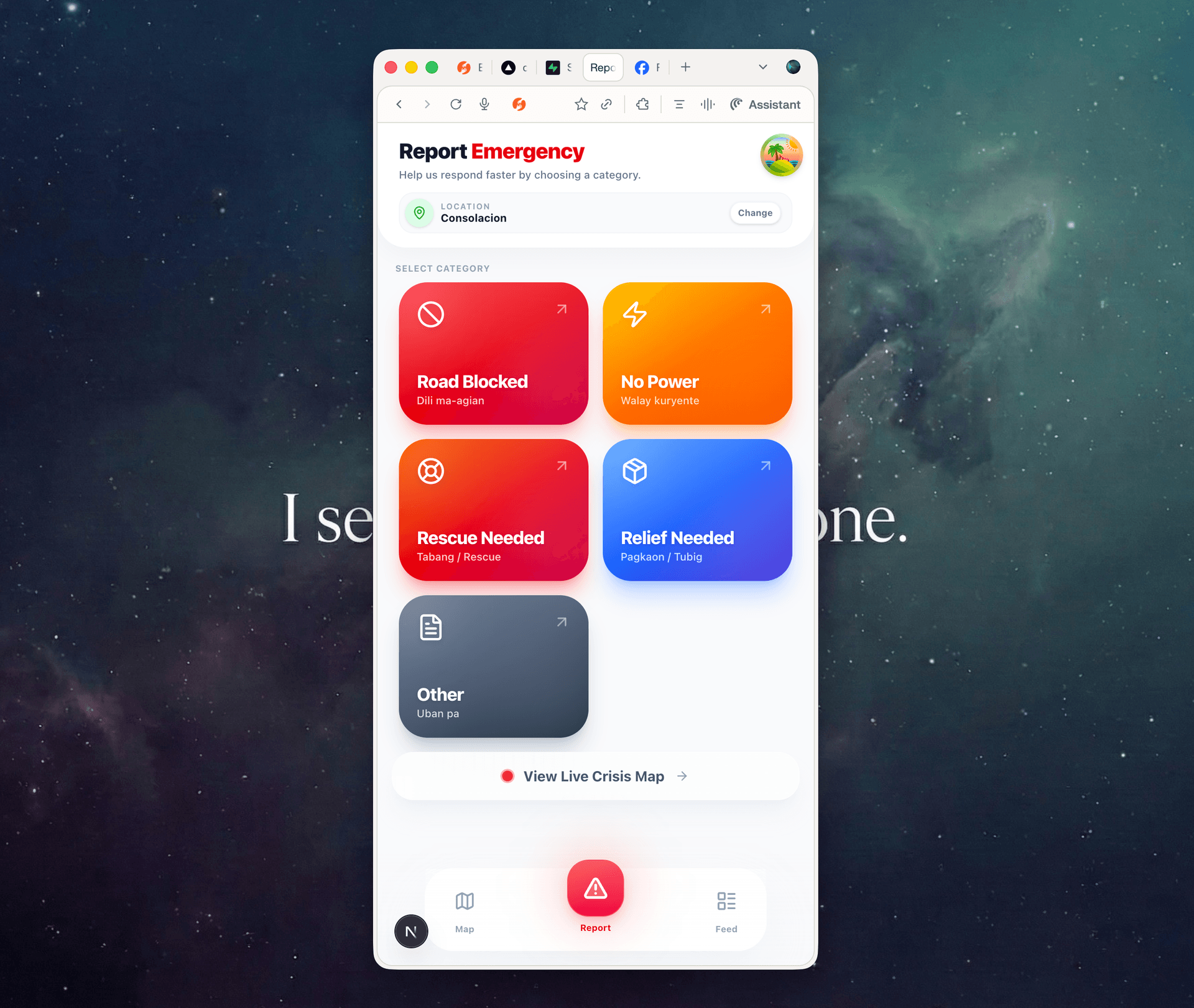
We designed the reporting interface (dasig.org/report) with one metric in mind: 60 seconds or less. Whether you're reporting in a storm with shaking hands or snapping a photo of a broken guardrail on your commute, you shouldn't need to navigate complex menus. Our “Speed Over Perfection” philosophy means:
- No App Install — Open your phone browser. That's it. No app store, no downloads, no storage wasted.
- GPS-First — Location is auto-detected. One tap to confirm. No typing addresses in the dark.
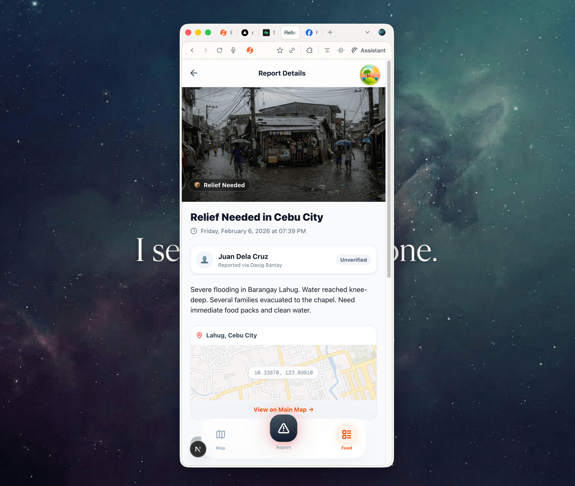
- Visual Categories — Large, tap-friendly icons for Flood, Road Damage, Power Outage, Downed Pole, Pothole, Rescue Needed, Relief Needed, and more. No typing required.
- Low Bandwidth — Optimized for the degraded connections typical during typhoons—but just as smooth on everyday mobile data. Reports queue and send when signal returns.
Meeting People Where They Are
We know the reality: not everyone is comfortable with a web form, and not every barangay has reliable mobile data. Technology adoption is a journey, not a switch. That's why Dasig Bantay is expanding its upstream intake channels beyond the browser:
The channel doesn't matter. Every report—whether it comes from a web form, an SMS, or a phone call—enters the same centralized pipeline. One system. One source of truth. No more stitching together five different platforms to understand what's happening.
The Public Crisis Map: Transparency & Trust
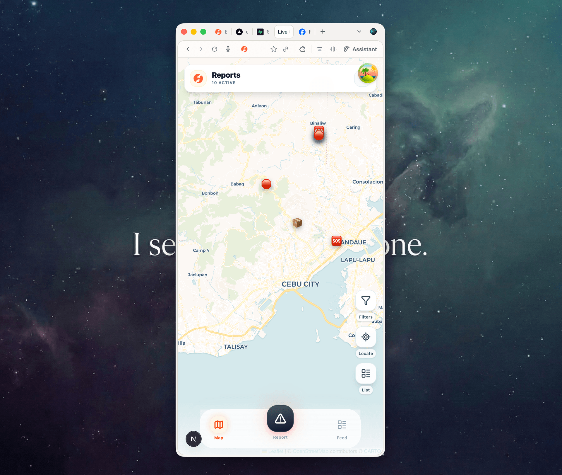
Once a report enters the pipeline, verified incidents appear on the public crisis map (dasig.org/map).
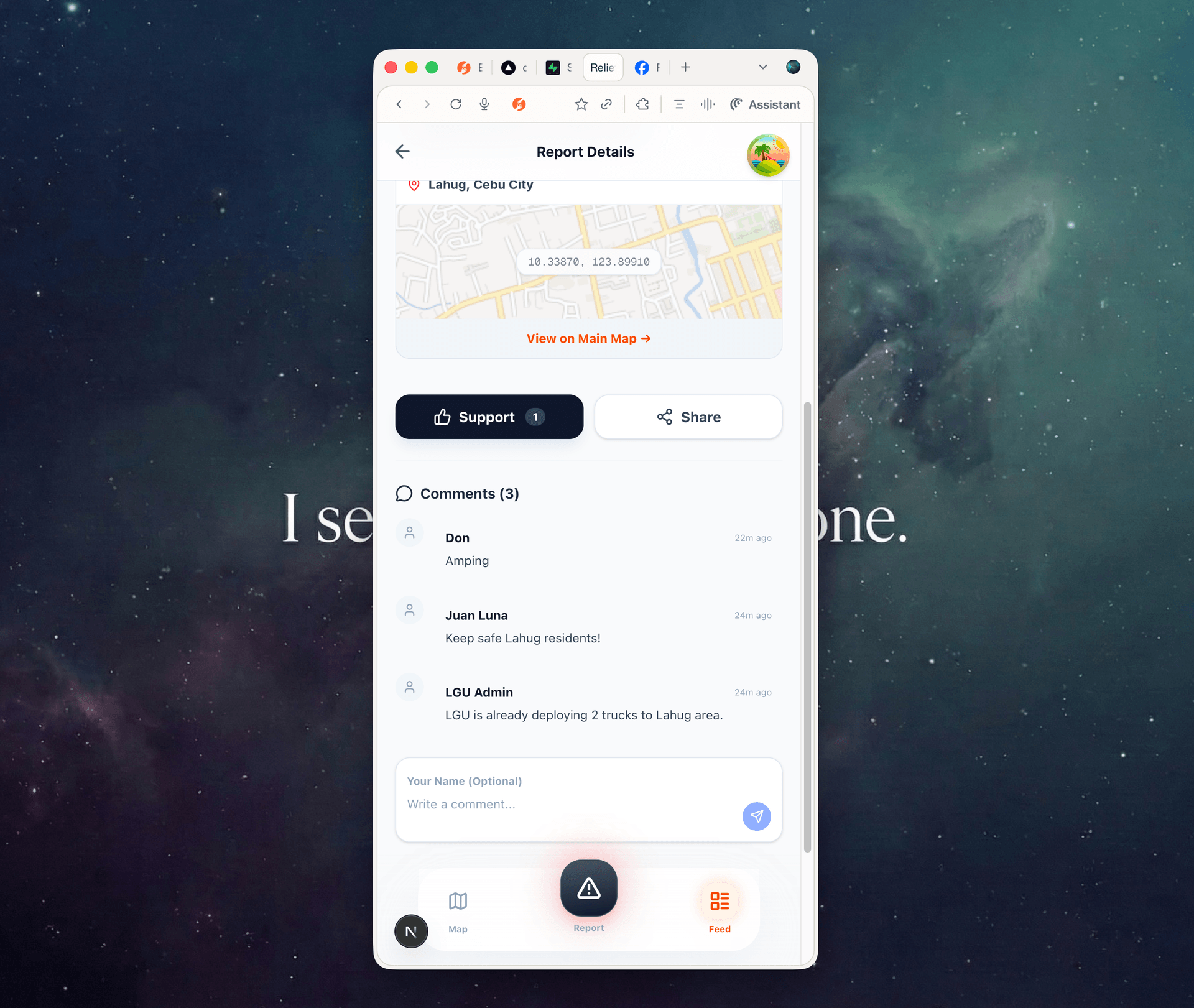
This transparency is not a nice-to-have—it's the engine of participation. When a citizen submits a report and sees it appear on the map (anonymized for safety), they know their voice was heard. That feedback loop is what separates a tool people use once from a tool communities rely on.
It also eliminates duplicate reporting. If you see a “Road Blocked” pin on your street, you upvote it (“I see this too”) instead of filing a new ticket. The map self-organizes.
The public map allows anyone to view verified incidents in real-time—no login required.
Downstream: The Dispatcher & First Responders
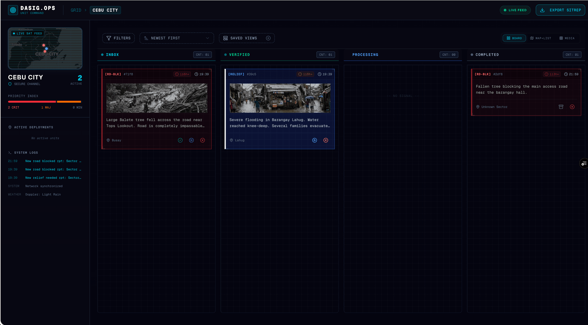
Collecting reports is only half the equation. Without a dispatcher, upstream intelligence is just organized noise. The real value of Dasig Bantay is what happens after a citizen hits “Submit”—the report enters the LGU Ops Portal, where it becomes a deployment order.
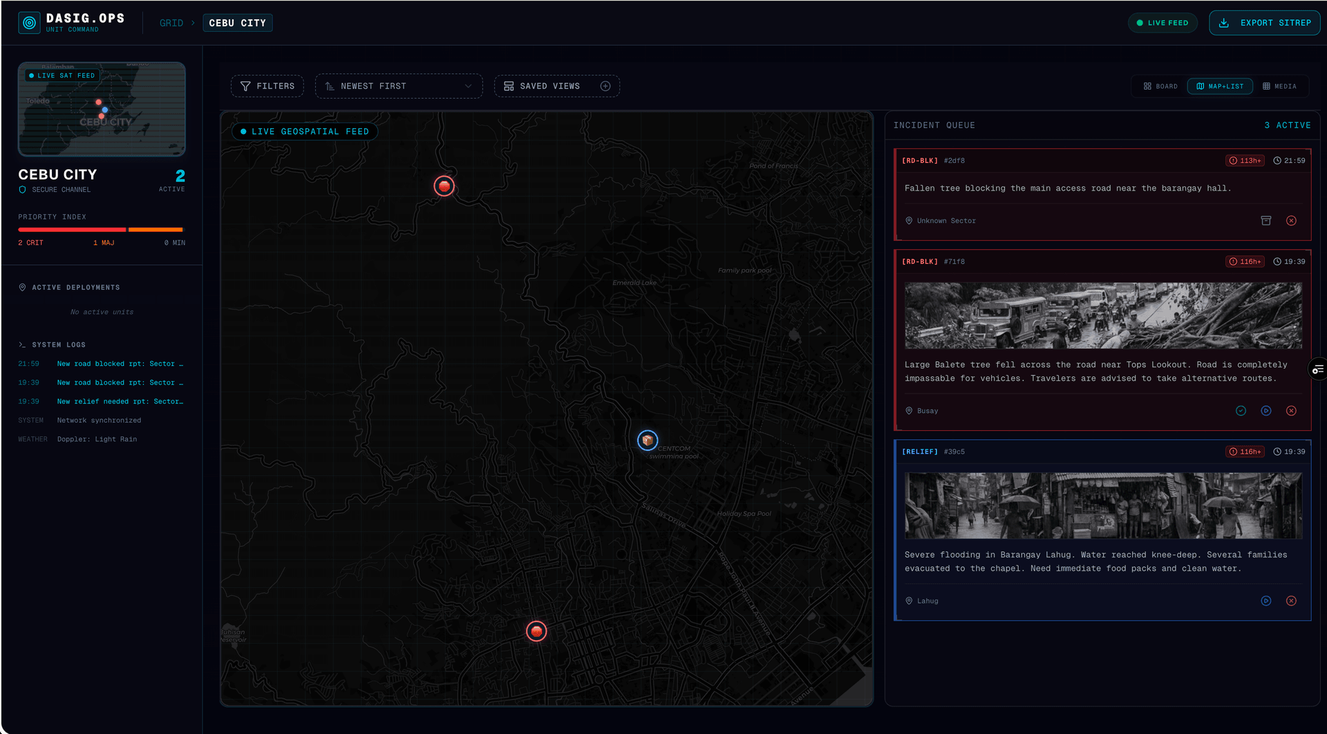
Think of the Ops Portal as the brain that turns raw citizen intelligence into structured Situation Reports (SitReps). An LGU commander can see at a glance: “5 verified road blocks in Barangay Lahug, 2 critical rescue requests in Guadalupe, 1 medical evacuation needed in Mabolo.” That clarity saves time. Time saves lives.
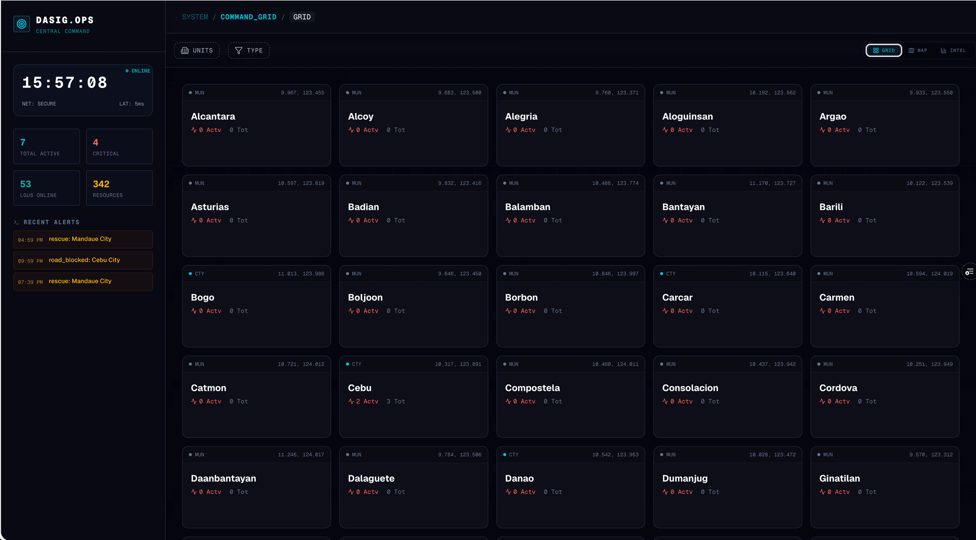
The Ops Portal: a filtered, real-time command view for each LGU jurisdiction.
Why Participatory Tech Matters
There is a deeper reason Dasig Bantay exists beyond operational efficiency. Disasters reveal whether communities have infrastructure for collective action—or just individual survival.
“In a crisis, people want to help. If you don't give them a channel, they'll create their own noise. If you give them a structure, they become your most powerful sensor network.”
Participatory technology is the idea that the people affected by a problem are the best source of intelligence about that problem. Not satellites. Not assessment teams arriving 48 hours later. The neighbor who is standing in floodwater right now, with a phone in hand.
By standardizing how we ask for help—“Category + Location + Photo”—we remove the cognitive load from the victim and the interpretation load from the responder. Both sides benefit. The citizen knows exactly what to report. The dispatcher receives uniform, actionable data instead of parsing paragraph-long Facebook posts.
This is also about participatory governance. When an LGU adopts Dasig Bantay, they are making a statement: “We trust our citizens to help us serve them better.” And when citizens see their reports turn into action on the map, they trust their LGU more. It's a virtuous cycle that strengthens the relationship between government and people.
Sustainability: Built for Adoption, Not Just Deployment
A tool that only works when foreign grants fund it is not infrastructure—it's a project. Dasig Bantay is designed to be sustainable through strategic partnerships, not perpetual donations.
Adopted by the Village, Not Imposed from Above
Technology adoption in the Philippines—especially in barangays—doesn't happen because a platform is technically superior. It happens because trusted local leaders champion it. Our adoption model starts at the barangay level:
- Barangay Captain Buy-In — We partner with the Punong Barangay to introduce Dasig Bantay as their official reporting tool, integrated into their existing BDRRMC (Barangay Disaster Risk Reduction Management Committee) workflows.
- Community Onboarding — Tanods, barangay health workers, and SK members are trained as first-line verifiers. They're already trusted by residents.
- Multi-Channel Access — For residents uncomfortable with a web form, we offer SMS, Messenger, and phone hotline channels. The tool adapts to the community, not the other way around.
Strategic Partnership Tiers
Sustainability isn't about charging disaster victims. It's about building an ecosystem of partners who benefit from better data and faster coordination:
The model is designed so that Dasig Bantay becomes more valuable as more villages adopt it. A province-level CDRRMO gets a unified dashboard across all participating municipalities. NGOs see relief needs across a wider geography. Each new barangay that joins strengthens the network for everyone.
What's Next: The Roadmap
We are just getting started. The roadmap extends from deepening community trust to building full interoperability with national and international systems.
Phase 2: Deepening Trust & Community (Active Now)
- Reporter Reputation — Optional sign-in to build “Reliable Reporter” status. Reports from verified users get prioritized in the triage queue.
- “Still Happening?” Polls — Community members validate whether incidents are ongoing, automatically clearing stale data.
- Volunteer Verification — Trusted community members can help verify reports before they reach the LGU dispatcher, reducing workload.
- Multi-Channel Intake — Rolling out SMS, Messenger, email, and phone hotline channels so no one is excluded by technology.
Phase 3: Open Ecosystem & Interoperability
Disaster data should not be locked inside any single platform. We are building towards full data portability:
Dasig means to cheer up, to encourage, and to be active. In the face of disaster, we don't just wait. We build the infrastructure so that when the next typhoon comes, the response is already organized—by the community, for the community.